Caminantes
Castrojeriz: the arch of San Antón, the castle and the climb to Mostelares
By August Frederik Kramer · Last updated 19 October 2026
Out of Hontanas. You leave Hontanas at 872 m. Ahead: 11.2 km of plain to the next hill, gently down 101 m, with only 30 m of climbing in all of it.
The arch of San Antón. After 5.6 km the road runs straight under the arch of a ruined convent. The monks here gave every pilgrim bread.
Castrojeriz. 9.3 km from Hontanas: Castrojeriz, one street more than a kilometre and a half long, under a hill with a ruined castle on top.
The wall. Over the little bridge, 1.9 km past the town, the plain stops. In front of you the track goes straight up the face of the Alto de Mostelares.
The top of Mostelares. 141 m up in 1.8 km, 12% at its steepest. The short climb has more in it than the 11.2 km of plain before it.
You are on top, at 911 m. 13.0 km from Hontanas and 171 m climbed in all. The far side is as steep: 123 m down in 3.3 km.
0.0km from Hontanas
872m high
0m climbed
Download the poster (PNG)Free to print and share. Please keep caminantes.co on it.
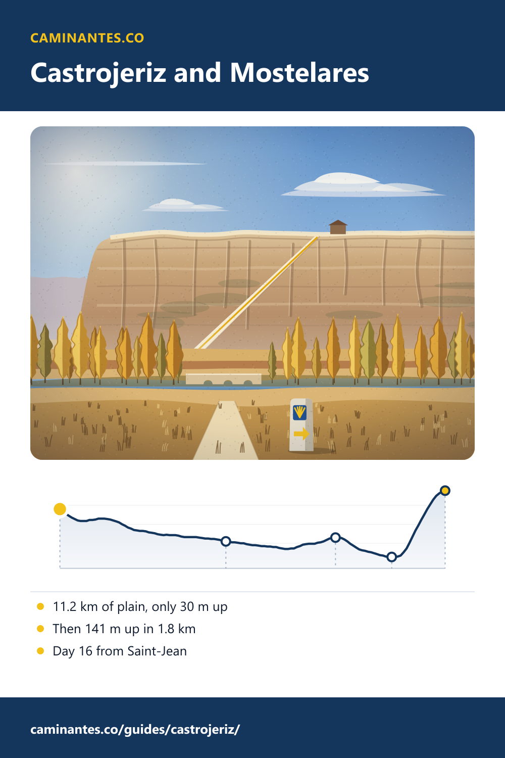
Castrojeriz is one long street at the foot of a castle hill, in the middle of the flattest part of the Camino Francés. The way out is a wall: the Alto de Mostelares climbs 141 m in 1.8 km, more than the whole 11.2 km before it. On our plan the town is early on day 16 from Saint-Jean, with 444.2 km to go.
The Alto de Mostelares, measured
From Hontanas to the foot of the hill is 11.2 km, and the ground drops 101 m on the way: only 30 m of climbing in all of it. Then, 1.9 km past Castrojeriz, at 771 m, the track turns straight up the face of the high plain: 141 m in 1.8 km, to 911 m at the top. The steepest half kilometre is 12%. The plain is about 6 times as long as the climb and has less climbing in it.
- Out of Hontanas0.0 km · 872 m · 0 m ↑
- The arch of San Antón5.6 km · 804 m · 6 m ↑
- Castrojeriz9.3 km · 812 m · 30 m ↑
- The wall11.2 km · 771 m · 30 m ↑
- The top of Mostelares13.0 km · 911 m · 171 m ↑
San Antón: the road under the arch
About 3.7 km before Castrojeriz the road passes under the arch of the convent of San Antón, founded by King Alfonso VII in 1146. Its monks, the Antonines, cared for pilgrims sick with “St Anthony’s fire”, a poisoning from mouldy rye, and gave every pilgrim the bread of St Anthony, marked with their sign, the Tau, a cross shaped like a T. The ruins are from the 14th century; the arch the pilgrims walked through is what still stands. On our plan, day 15 ends just past it, at Villaquirán de la Puebla.
Castrojeriz: a castle and a very long street
The town grew on the hill first: the castle on top was held by Count Nuño Núñez against the Moors at the end of the 9th century, and in 974 the town got its fuero, its charter of rights. Later the houses moved down to the Camino, so Castrojeriz is one street: more than 1.5 km of it, said to be the longest town street on the whole route. The hilltop is 919 m by the OpenStreetMap survey; the street sits at about 812 m on our profile. About 800 people live here.
The other side
The top is a short flat stretch, with a wide view back to the castle hill. The way down is as steep as the way up: 123 m in 3.3 km, 12% at its steepest. Take it slowly if your knees mind. The day goes on, flat again, over the Pisuerga at Itero and on to Boadilla del Camino.
Know these words before your Camino. Spanish is preparation, the same as boots and stages. Try the free topic
Where it is on the walk
On our plan of 36 days from Saint-Jean, day 16 runs from Villaquirán de la Puebla to Boadilla del Camino: 22.5 km and 241 m of climbing, more than half of it on Mostelares. Castrojeriz comes 3.4 km into the day, and from there it is 444.2 km to Santiago, 20 more days. From Burgos it is day 3. Climb in the cool of the morning: there is no shade on the face.
The next morning, along the Canal de Castilla to its four locks and San Martín: Frómista.
The whole meseta, day by day: the Camino from Burgos.
Every stage of the Francés, one by one: the stages guide.
Distances and heights: our own track and elevation profile of the Camino Francés, the same the stages and Burgos pages use. San Antón: Spanish Wikipedia, Monasterio de San Antón. The town, the castle, the fuero and the long street: Spanish Wikipedia, Castrojeriz. The castle hill’s height: OpenStreetMap.
Common questions
How steep is the Alto de Mostelares?
141 m of climbing in 1.8 km on our profile, 12% at its steepest half kilometre, from 771 m to 911 m. The descent on the far side is 123 m in 3.3 km.
What is the arch of San Antón?
The ruins of a convent founded in 1146, where Antonine monks cared for sick pilgrims and gave every pilgrim bread. The road to Castrojeriz runs under its arch, about 3.7 km before the town.
How far is Castrojeriz from Santiago?
444.2 km on our track of the Camino Francés, 20 more days on our stage plan.
Which day of the Camino Francés is Castrojeriz?
Day 16 from Saint-Jean on our plan, day 3 from Burgos. The town comes 3.4 km into the day from Villaquirán de la Puebla to Boadilla del Camino, 22.5 km.
Keep reading
Triacastela to Sarria: the Samos way is 4.2 km longer and 210 m lower
San Xil climbs one hill to 884 m; Samos follows the river past one of the oldest monasteries in Spain, and still climbs more. Walk both and watch the climb add up.
Santo Domingo de la Calzada: the cathedral with live chickens
A white hen and rooster live in the cathedral, for a roast pair that crowed. Tap through the legend, then plan it: the town ends day 9 from Saint-Jean.
Melide: where the Camino gets 13% busier
The Primitivo joins the Francés here, 52.9 km from Santiago. Send the two crowds into one path, then stop for pulpo á feira.
Take it with you
Caminantes is free, works offline, and plans your stages around your own legs rather than a guidebook's.