Caminantes
Palas de Rei: the hardest day from Sarria, over the Sierra Ligonde
By August Frederik Kramer · Last updated 21 October 2026
Portomarín. You leave at first light, with mist on the reservoir below the town and the long bridge you crossed yesterday behind you.
Castromaior. The hillfort of Castromaior, 9.1 km out: its terraces and earth banks still ring the hill beside the path. You have climbed 274 m.
Sierra Ligonde. The top of the day and of the whole walk from Sarria: 724 m, 13.7 km out. 79% of the day’s climbing is behind you.
Ligonde. Ligonde, 16.0 km out: granite houses, a granary on stone legs, and a stone cross by the old way. From here it is mostly downhill.
Palas de Rei. The end of the day. The church tower of San Tirso, the first lit windows, and a bed.
24.9km from Portomarín
512m climbed
Day done: 24.9 km and 512 m of climbing. Day 2 of 5 from Sarria, day 33 from Saint-Jean, with 67.5 km left to Santiago.
Download the poster (PNG)Free to print and share. Please keep caminantes.co on it.
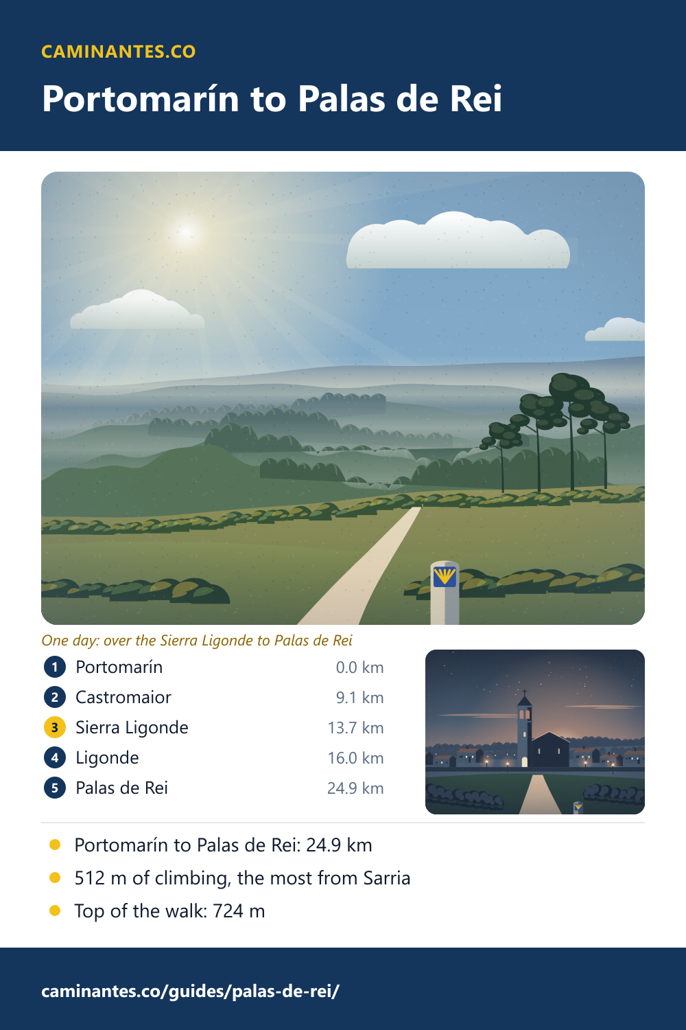
Palas de Rei is where the second day out of Sarria ends, and it is the hardest of the five: 24.9 km with 512 m of climbing, up from the reservoir at Portomarín to 724 m on the Sierra Ligonde, the highest point between Sarria and Santiago. From Palas de Rei it is 67.5 km to go.
The climb out of Portomarín
Portomarín sits low, by the reservoir on the Miño, at about 355 m on our track. The day climbs almost at once and keeps climbing: 405 m in 13.7 km, past the hillfort of Castromaior and the hamlet of Ventas de Narón (13.0 km), to 724 m on the Sierra Ligonde. That is the highest point between Sarria and Santiago, and 79% of the day’s climbing is done by then. The last 11.2 km are kinder: 284 m down and only 107 m up, into Palas de Rei at about 546 m. With 512 m in all, no other day from Sarria climbs as much. Start early and keep water for the open crest, where there is little shade.
Where the day starts, and why you cannot start there: Portomarín.
Castromaior and Ligonde
At Castromaior, 9.1 km out, the path passes a castro, one of the old hillforts of Galicia: a higher enclosure with others joined to it, terraces held by earth banks and ditches, still plain to see from the path. After the top the way drops to Ligonde, 16.0 km out, a hamlet of granite houses and hórreos, the Galician granaries raised on stone legs, with a stone wayside cross, a cruceiro, by the old road. Crosses like it stand at crossroads and church doors all over Galicia.
The king’s palace
The name comes from “Palatium Regis”, the king’s palace, as a document of 1153 calls it; tradition ties it to a palace of the Visigothic king Witiza. The Codex Calixtinus, the pilgrims’ guide of the 12th century, already names Palas as a stop before the last stretch to Santiago. Two sights lie off the Camino near the town: the Romanesque church of Vilar de Donas, founded in the mid-12th century and known for its wall paintings, among the best preserved in Galicia, and the castle of Pambre, raised by Gonzalo Ozores de Ulloa around 1375.
The next morning: pulpo in Melide
The next day runs to Arzúa, 28.3 km with 455 m of climbing, and its halfway mark is the best known lunch on the Camino: Melide, 14.3 km from Palas de Rei, where the Camino Primitivo joins and the pulperías serve octopus on wooden plates.
Where the next day stops for lunch: Melide, where two Caminos become one.
The day in figures
On our plan of the Camino Francés this is day 33 of 36 from Saint-Jean and day 2 of 5 from Sarria: Portomarín to Palas de Rei, 24.9 km with 512 m of climbing and 318 m of descent. Palas de Rei is 46.9 km from Sarria and 67.5 km from Santiago, 3 days to go.
Every stage of the Francés, one by one: the stages guide.
Distances, climbs and days are measured on our track of the Camino Francés, the same rows the Portomarín and Melide pages print; the villages are placed on that track from OpenStreetMap. The name, the Codex, Vilar de Donas and Pambre are from the Spanish and English Wikipedia on Palas de Rei; the hillfort from the Galician Wikipedia on the castro of Castromaior. The drawings are pictures of the day, not surveys.
Common questions
How far is it from Portomarín to Palas de Rei?
24.9 km on our track, with 512 m of climbing and 318 m of descent. The top is on the Sierra Ligonde, 13.7 km out of Portomarín, at 724 m.
Is Portomarín to Palas de Rei the hardest day from Sarria?
On our track it climbs the most of the five days from Sarria, 512 m, and it reaches the highest point between Sarria and Santiago, 724 m. Most of the climbing comes in the first 13.7 km.
How far is Palas de Rei from Santiago?
67.5 km on our track of the Camino Francés, 3 days on our stage plan.
How far is it from Palas de Rei to Melide?
14.3 km on our track. The full day on our plan goes on to Arzúa, 28.3 km.
Where does the name Palas de Rei come from?
From “Palatium Regis”, the king’s palace, as a document of 1153 calls the place. Tradition ties it to the Visigothic king Witiza.
Keep reading
Rabanal del Camino: halfway up to the Cruz de Ferro
From Astorga to the stone village of Rabanal in five pictures: the gentle half of the climb to the cross, walked and measured, with the monks’ chant at the end.
Estella and the Irache wine fountain
Walk Puente la Reina to Estella in pictures, 21.3 km through Cirauqui and the vines, then on to the fountain that pours wine for pilgrims.
Sahagún: is it really the halfway point of the Camino?
Sahagún calls itself the centre of the Camino Francés. We measured: the middle is out on the empty plain at km 384.3, and the town comes 24.1 km later. Walk to it.
Take it with you
Caminantes is free, works offline, and plans your stages around your own legs rather than a guidebook's.