Caminantes
Rabanal del Camino: the stone village halfway up to the Cruz de Ferro
By August Frederik Kramer · Last updated 21 October 2026
Astorga. You leave Astorga at 873 m, past the cathedral and the bishop’s palace. Ahead is the Maragatería, a dry upland of stone villages rising slowly towards the mountains.
Murias de Rechivaldo. 4.7 km out: Murias de Rechivaldo, the first Maragato village. Stone houses face the street with one big arched gateway each, made for the carts of the old muleteers.
Santa Catalina de Somoza. 9.2 km, 983 m: Santa Catalina de Somoza. The trees thin out, heather and broom cover the low hills, and the mountains of León come into view.
El Ganso. 13.4 km: El Ganso, a few stone houses on the moor at 1,016 m. From here the way climbs more steadily: 142 m in the last 7.1 km.
Rabanal del Camino. 20.5 km from Astorga, at 1,151 m. Stone houses, a small Romanesque church and, next door, monks who sing Gregorian chant.
You are in Rabanal, at 1,151 m. 20.5 km from Astorga and 309 m climbed: about half the way up to the Cruz de Ferro. Tomorrow, 344 m more in 7.5 km.
0.0km from Astorga
873m high
0m climbed
Download the poster (PNG)Free to print and share. Please keep caminantes.co on it.
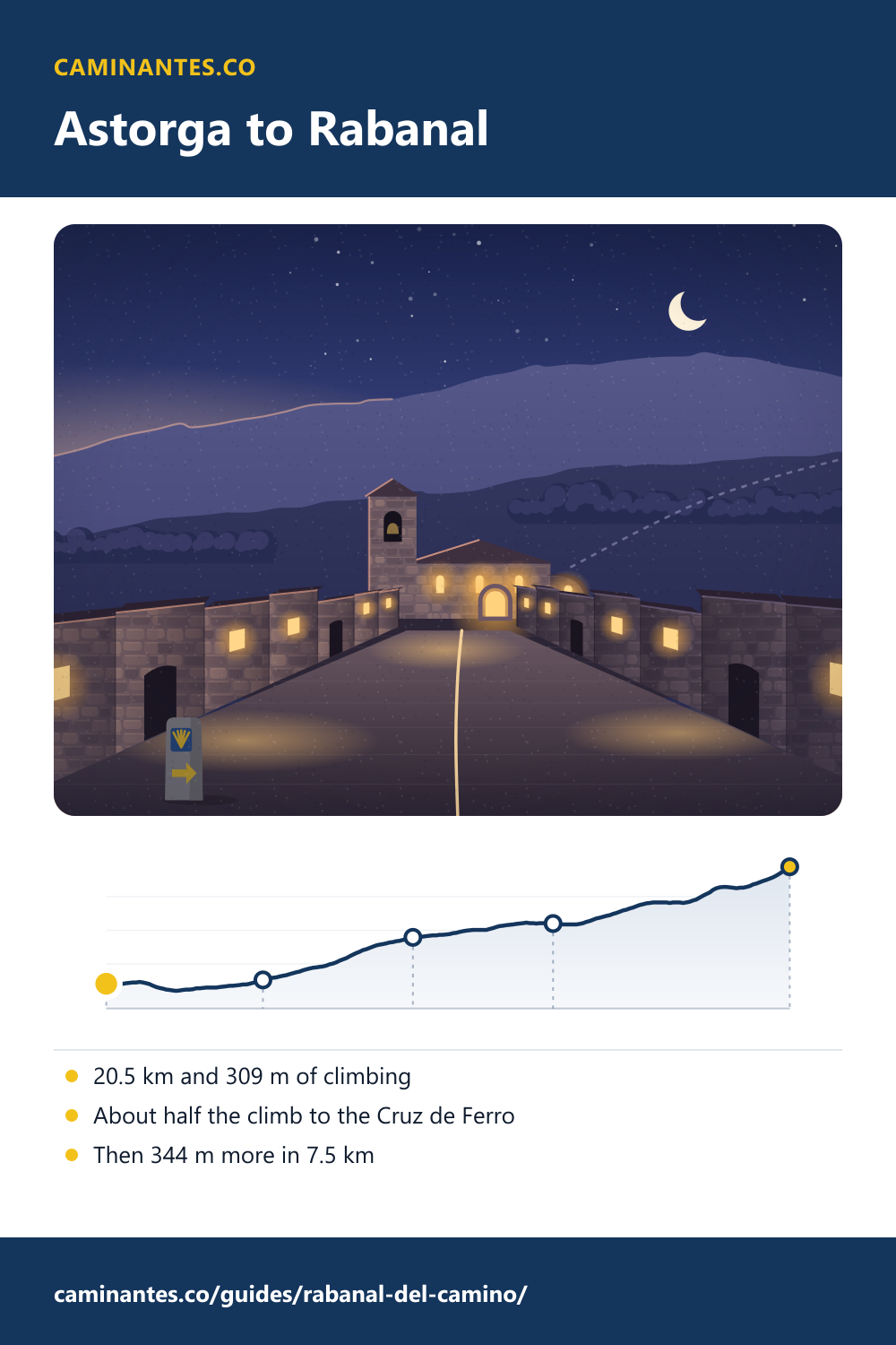
Rabanal del Camino is a stone village at 1,151 m, the last big stop before the Cruz de Ferro. From Astorga it is 20.5 km with 309 m of climbing, so gradual you hardly notice it. That is about half the climb to the cross. The other half, 344 m, comes in the next 7.5 km.
Half the climb, most of the distance
From Astorga at 873 m to Rabanal at 1,151 m is 20.5 km with 309 m of climbing, and the steepest half kilometre is only 5%. From Rabanal to the Cruz de Ferro at 1,494 m is 7.5 km with 344 m of climbing, 8% at its steepest. So in Rabanal you have done 47% of the climbing to the cross, over about 3 times the distance of what is left. That is why so many people stop here: the steep half is best walked in the cool of the morning.
- Astorga0.0 km · 873 m · 0 m ↑
- Murias de Rechivaldo4.7 km · 882 m · 31 m ↑
- Santa Catalina de Somoza9.2 km · 983 m · 132 m ↑
- El Ganso13.4 km · 1,016 m · 167 m ↑
- Rabanal del Camino20.5 km · 1,151 m · 309 m ↑
A Maragato village of stone
Rabanal lies in the Maragatería, the land of the Maragato muleteers who carried goods across Spain from the 16th to the 19th century. The village has kept its old architecture well: stone houses with big doorways onto the street. The small church of Santa María has Romanesque remains and once belonged to the Knights Templar of Ponferrada. Fewer than a hundred people live here all year.
The monks and the chant
In 2001 a Benedictine abbey was founded in the village, San Salvador del Monte Irago. Next door is the Refugio Gaucelmo, a donativo hostel (you give what you can) opened in 1991 by the Confraternity of Saint James, a British pilgrims’ association, and open from April to October. Among what it offers pilgrims, it lists the Gregorian chant of the monks next door. Service times change, so ask in the village.
Tomorrow: the Cruz de Ferro
Out of Rabanal the way gets steeper at once. Foncebadón comes first, then the iron cross at 1,494 m, 7.5 km from Rabanal and 27.9 km from Astorga. Up there the weather turns fast, with fog and wind and, in winter, snow. Start early and carry a warm layer.
The cross, the real top and the long way down: the Cruz de Ferro.
Where it is on the walk
On our plan of 36 days from Saint-Jean, the first day from Astorga is 17.8 km and stops 2.7 km short of Rabanal. Rabanal comes 2.7 km into the next day, day 26 from Saint-Jean and day 2 from Astorga: 27.4 km and 487 m of climbing, over the Cruz de Ferro and down to Molinaseca. Many people end the first day in Rabanal instead, 20.5 km from Astorga. From Rabanal it is 236.2 km to Santiago.
Every day from Astorga, measured: the Camino from Astorga.
Every stage of the Francés, one by one: the stages guide.
Distances and heights: our own track and elevation profile of the Camino Francés, the same the Astorga and Cruz de Ferro pages use. The village, the muleteers, the church, the Templars and the abbey: Spanish Wikipedia, Rabanal del Camino. The Refugio Gaucelmo and the chant: the Confraternity of Saint James.
Common questions
How far is Rabanal del Camino from Astorga?
20.5 km on our track, with 309 m of climbing, from 873 m in Astorga to 1,151 m in Rabanal.
How far is Rabanal from the Cruz de Ferro?
7.5 km, with 344 m of climbing through Foncebadón, up to the cross at 1,494 m.
Can you hear the monks sing in Rabanal?
The village has a Benedictine abbey, San Salvador del Monte Irago, founded in 2001, and the Refugio Gaucelmo next door lists the monks’ Gregorian chant among what it offers pilgrims. Service times change, so ask in the village.
Which day of the Camino Francés is Rabanal?
On our plan it comes 2.7 km into day 26 from Saint-Jean, day 2 from Astorga. Many people end their first day from Astorga here, after 20.5 km.
Keep reading
Estella and the Irache wine fountain
Walk Puente la Reina to Estella in pictures, 21.3 km through Cirauqui and the vines, then on to the fountain that pours wine for pilgrims.
Sahagún: is it really the halfway point of the Camino?
Sahagún calls itself the centre of the Camino Francés. We measured: the middle is out on the empty plain at km 384.3, and the town comes 24.1 km later. Walk to it.
Puente la Reina: over the Alto del Perdón to the queen’s bridge
Walk the first day out of Pamplona in five pictures: up past the iron pilgrims on the Perdón, down the stones, to the bridge built for pilgrims. 24.1 km.
Take it with you
Caminantes is free, works offline, and plans your stages around your own legs rather than a guidebook's.