Caminantes
Puente la Reina: over the Alto del Perdón to the queen’s bridge
By August Frederik Kramer · Last updated 19 October 2026
Pamplona. You leave the city at first light, out past the old walls and west, towards a ridge of wind turbines on the skyline.
Zariquiegui. The last village before the top, 11.1 km out. You have climbed 242 m, and the turbines on the ridge keep getting bigger.
Alto del Perdón. The top of the day, 13.3 km out. A row of pilgrims cut from iron walks the crest with you, under the turning blades.
Down the stones. The way down is steep and stony: 254 m down in the 3.6 km to Uterga. In the fields below stands the octagonal church of Eunate, then Obanos on its hill.
Puente la Reina. The end of the day. The bridge that gave the town its name waits at the end of the main street, for the morning.
24.1km from Pamplona
394m climbed
Day done: 24.1 km and 394 m of climbing. Day 4 from Saint-Jean, day 1 from Pamplona, with 677.0 km left to Santiago.
Download the poster (PNG)Free to print and share. Please keep caminantes.co on it.
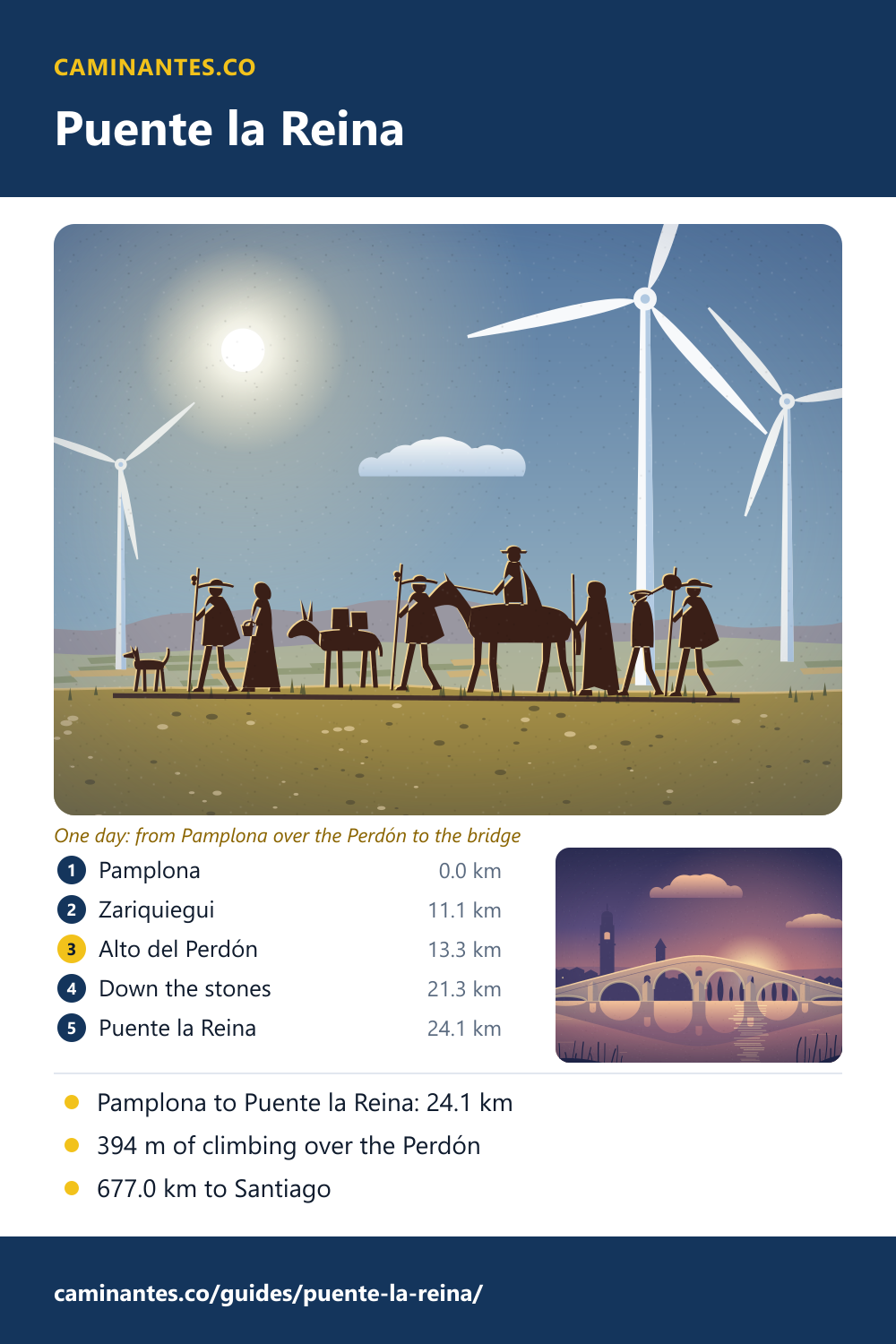
Puente la Reina is where the first day out of Pamplona ends: 24.1 km with 394 m of climbing, up to the iron pilgrims on the Alto del Perdón and down to a bridge built for pilgrims in the 11th century. Here the Camino Francés and the Camino Aragonés become one road, with 677.0 km to go.
Up to the Alto del Perdón
The top comes 13.3 km out of Pamplona, after about 370 m of climbing: 93% of the whole day’s climb is done by then. The ridge stands at about 770 m and carries a line of wind turbines, put up from 1994. Along the crest walks a procession cut from sheet iron, pilgrims of different centuries, made by the sculptor Vicente Galbete in 1996, with a line written on it: “where the path of the wind crosses that of the stars”. From there it is downhill to the bridge, 426 m down in 10.8 km, and the steepest part comes first: 254 m on loose stones in the 3.6 km to Uterga. Poles help.
The detour to Eunate
At Muruzábal a marked path leaves the Camino for Santa María de Eunate, a Romanesque church from the second half of the 12th century that stands alone in the fields: an irregular octagon wrapped in a gallery of 33 arches. Scallop shells were found in its graves, and it probably looked after pilgrims. On our track the detour is 4.8 km where the direct way is 1.6 km, so it adds 3.2 km, and it rejoins the Camino before Obanos. With it the day is 27.3 km.
The queen’s bridge
The town is named after its bridge, a Romanesque bridge over the river Arga built in the 11th century for the pilgrims, probably on the orders of a queen, doña Mayor. Its deck rises in a hump over round arches. The Calle Mayor follows the Camino straight through town to it, past the church of Santiago with its Romanesque doorway; at the way in, the church of the Crucifijo keeps a Gothic Christ of German origin on a cross shaped like a Y. The bridge is the way out, 0.3 km past the end of our day: you cross it the next morning. In Basque the town is Gares.
Where the Caminos become one
In Puente la Reina the Camino Francés meets the Camino Aragonés, which crosses the Pyrenees further east, at the Somport pass. From here on, as the town puts it, “all the ways to Santiago become one”: 677.0 km of it on our track.
The day in figures
On our plan of the Camino Francés this is day 4 of 36 from Saint-Jean and day 1 from Pamplona: Pamplona to Puente la Reina, 24.1 km with 394 m of climbing and 504 m of descent. Puente la Reina is 91.6 km from Saint-Jean and 677.0 km from Santiago, 32 days to go. The next day runs to Estella-Lizarra, 21.3 km with 341 m of climbing.
Know these words before your Camino. Spanish is preparation, the same as boots and stages. Try the free topic
Where the next day ends: Estella, and the morning after, the wine fountain of Irache, walked in pictures.
The whole walk from Pamplona, day by day: the Camino from Pamplona.
Every stage of the Francés, one by one: the stages guide.
Distances, climbs and days are measured on our track of the Camino Francés, the same rows the Pamplona page prints; the bridge, the villages and the Eunate detour are placed on that track from OpenStreetMap. The bridge, the town and the meeting of the Caminos are from the Spanish Wikipedia on Puente la Reina and on the Camino Aragonés; the iron pilgrims, the turbines and the height of the ridge from the article on the Alto del Perdón; the church from the article on Eunate. Wikipedia counts the bridge’s arches two ways, so we give no count.
Common questions
How far is it from Pamplona to Puente la Reina?
24.1 km on our track, with 394 m of climbing and 504 m of descent. The top of the day is the Alto del Perdón, 13.3 km out of Pamplona.
How far is Puente la Reina from Santiago?
677.0 km on our track of the Camino Francés, 32 days on our stage plan.
How long is the detour to Eunate?
It leaves the Camino at Muruzábal and rejoins it before Obanos. On our track it adds 3.2 km, which makes the day from Pamplona 27.3 km.
Which Caminos meet in Puente la Reina?
The Camino Francés and the Camino Aragonés, which crosses the Pyrenees at Somport. From Puente la Reina they are one road to Santiago.
Is the descent from the Alto del Perdón hard?
It is the steepest part of the day: 254 m down in the 3.6 km to Uterga, on loose stones. Poles and a slow pace help.
Keep reading
Arzúa: two days left to Santiago
Santiago is 39.2 km away: 19.9 km to O Pedrouzo, then 19.3 km. Walk the countdown stop by stop, and pick out the town’s cheese.
Castrojeriz: the arch of San Antón and the climb to Mostelares
A morning of flat plain, a road under a ruined arch, a town under its castle, then a wall. Walk it stop by stop and watch the climb count up: day 16 from Saint-Jean.
Triacastela to Sarria: the Samos way is 4.2 km longer and 210 m lower
San Xil climbs one hill to 884 m; Samos follows the river past one of the oldest monasteries in Spain, and still climbs more. Walk both and watch the climb add up.
Take it with you
Caminantes is free, works offline, and plans your stages around your own legs rather than a guidebook's.