Caminantes
Carrión de los Condes and the long road with no village
By August Frederik Kramer · Last updated 22 October 2026
Carrión de los Condes. Fill your water here: no village and no shop for the next 17.1 km, all the way to Calzadilla de la Cueza.
The river and San Zoilo. 0.9 km out you cross the river Carrión by the old bridge, with the monastery of San Zoilo beside the way.
The Fuente del Hospitalejo. 7.3 km out, a spring in a stand of poplars. From here the Roman road runs straight on: 9.7 km to Calzadilla.
The middle of the Camino. You are at the middle of the whole Camino Francés: km 384.3 from Saint-Jean, 1.1 km before Calzadilla. Nothing marks it.
Calzadilla de la Cueza. 17.1 km from Carrión and only 43 m of climbing, all of it in the open.
Leaving at 07:00 at 4 km/h, you reach Calzadilla at 11:17: 4 h 17 min with no village.
17.1km to Calzadilla
07:00on the clock
Download the poster (PNG)Free to print and share. Please keep caminantes.co on it.
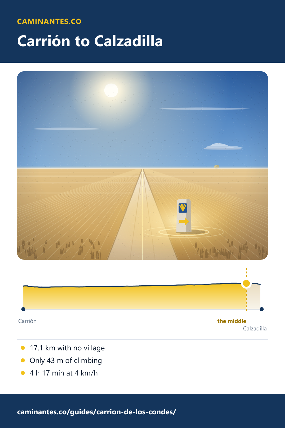
Carrión de los Condes is a town of Romanesque churches at the end of day 17 on our plan. The next morning the Camino leaves on the old Roman road, and there is no village for 17.1 km, until Calzadilla de la Cueza. Between two villages, no gap on the Camino Francés is longer.
The stretch, measured
On our track Calzadilla de la Cueza is 17.1 km from Carrión de los Condes. The road climbs 43 m in all and never gets above 872 m: this is not hard walking, it is long and open. The ruins of the Abadía de Benevívere come 4.9 km out, the Fuente del Hospitalejo 7.3 km out, and then the old road runs straight for 9.7 km. The villages you may see on the map, off to the side, are more than 1.8 km from the way. At 4 km/h it takes 4 h 17 min.
The longest gaps on the Camino Francés
We measured every gap between one village and the next along our track of the Francés. Carrión to Calzadilla is 17.1 km, 3.9 km more than the next longest on the plain, El Burgo Ranero to Reliegos (13.2 km). Only the crossing of the Pyrenees is longer: about 18 km from the lone refuge at Orisson to Roncesvalles, over the mountain.
What to carry
We give no number of litres: it depends on the day’s heat and on you. What the guides agree on is plain. Gronze says to carry water and food for this stretch in any case; in season a few stalls sometimes set up along the way, but do not plan on one. There is little shade after the poplars at the Fuente del Hospitalejo. Fill up in Carrión, and leave early in summer.
Carrión de los Condes
Two Romanesque churches stand on the way through town. Santa María del Camino is from the 12th century; its doorway tells the miracle of the maidens, the bulls that freed the young women of Carrión from being handed over as tribute to the Moorish kings. The Iglesia de Santiago is from the 13th; its Pantocrátor is counted among the high points of Romanesque sculpture, and its doorway shows twenty-two craftsmen at work. Over the river stands the Benedictine monastery of San Zoilo, with a Plateresque cloister. By tradition the counts Gómez Díaz and Teresa Peláez refounded it, and gave the town its bridge.
Know these words before your Camino. Spanish is preparation, the same as boots and stages. Try the free topic
On the Roman road
The way out of Carrión follows the Roman road that ran from Bordeaux to Astorga, called the vía Aquitania in the Middle Ages. After the ruins of Benevívere the Camino takes the old road and keeps to it, dead straight across the plain, until the church tower of Calzadilla de la Cueza comes into view. The middle of the whole Camino Francés is out here too, 1.1 km before the village.
Where it is on the walk
On our plan of 36 days from Saint-Jean, day 17 runs from Boadilla del Camino to Carrión de los Condes: 24.8 km and 102 m of climbing. Day 18 leaves Carrión for Población de Arroyo: 22.4 km, 94 m up, and 5.4 km more after Calzadilla. From Burgos these are days 4 and 5. From Carrión it is 400.3 km to Santiago.
Two days before: Castrojeriz and the climb to Mostelares.
The middle of the Camino, and the town that claims it: Sahagún, measured.
The whole meseta, day by day: the Camino from Burgos.
Every stage of the Francés, one by one: the stages guide.
Distances and heights: our own track, elevation profile and stage plan of the Camino Francés, the same the stages, Burgos and Sahagún pages use; the gaps from the app’s map of the villages (OpenStreetMap). The churches, San Zoilo and the Roman road: Spanish Wikipedia, Carrión de los Condes. The longest stretch without villages, water and stalls: Gronze. Benevívere, the fountain and the straight road: Terranostrum.
Common questions
How far is it from Carrión de los Condes to Calzadilla de la Cueza?
17.1 km on our track, with no village on the way and 43 m of climbing. At 4 km/h that is 4 h 17 min.
Is there water between Carrión and Calzadilla?
Do not count on it. There is no village on the way. Gronze says to carry water and food in any case; in season a few stalls sometimes set up on the way.
Is it the longest stretch without villages on the Camino Francés?
Between two villages, yes: 17.1 km on our track. Only the crossing of the Pyrenees, about 18 km from the refuge at Orisson to Roncesvalles, is longer.
Which day of the Camino Francés is Carrión de los Condes?
The end of day 17 of 36 from Saint-Jean on our plan, day 4 from Burgos. Day 17 runs from Boadilla del Camino, 24.8 km.
Keep reading
Palas de Rei: the hardest day from Sarria, over the Sierra Ligonde
Walk the day from Portomarín in five pictures: past the hillfort, up to the highest point between Sarria and Santiago, down to Palas de Rei. 24.9 km.
Rabanal del Camino: halfway up to the Cruz de Ferro
From Astorga to the stone village of Rabanal in five pictures: the gentle half of the climb to the cross, walked and measured, with the monks’ chant at the end.
Estella and the Irache wine fountain
Walk Puente la Reina to Estella in pictures, 21.3 km through Cirauqui and the vines, then on to the fountain that pours wine for pilgrims.
Take it with you
Caminantes is free, works offline, and plans your stages around your own legs rather than a guidebook's.